


Ted Fay Fly Shop Reports:Below is a statement from PG&E:
I am currently the assigned License Coordinator on PG&E’s McCloud-Pit Project. We were recently alerted to a developing situation on the McCloud River system. Turbid water on the McCloud River is being caused by mud flows from Mud Creek. During dry years, the Konwakiton (Mud Creek) glacier on the south side of Mount Shasta is very exposed with the low snow accumulation and the excessive glacier melt begins carving through deep ash deposits on the mountain. This “river of mud” is a natural occurrence during low snow years and has occurred seven times in the past 100 years. The worst occurrences were in 1924, 1926 and 1930, all very dry years.
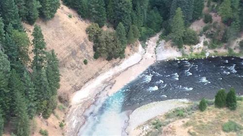
Mud Creek flows into the McCloud River upstream of PG&E’s McCloud Reservoir (see attached photo taken by PG&E this morning). As the muddy water is heavier, it flows to the bottom of the reservoir and is spilled out of the dam’s lower outlets. However, the reservoir is showing signs of increased turbidity near the surface.
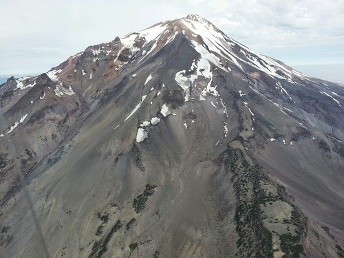
Konwakiton Glacier
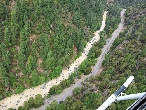 McCloud River Between Dam and Ash Camp
Read more
Craig Nielsen Reports: Flows on the Upper Sacramento River have been at summertime norms for several weeks. Springs on the upper river keep water temps low so the entire river remains very wadable ...
I am posting this email that I received from David Lass of Trout Unlimited today regarding the projected flows here in the Truckee Watershed and also to let everyone know about a dive team t...

Leave a comment
All comments are moderated before being published.
This site is protected by hCaptcha and the hCaptcha Privacy Policy and Terms of Service apply.